
Dinuba ZIP Code Directory Coverage
Research supports one conclusive answer for Dinuba: 93618 is the only ZIP code verified as serving the city. It also reaches rural postal territory, including London Branch Library at 5711 Ave 378. That makes 93618 useful for delivery checks, but not a clean outline of incorporated Dinuba. No split, realignment, or second Dinuba ZIP has been verified. The lead row below therefore stays narrow. It records what the postal evidence supports without turning nearby places, statistical zones, or a mailing label into extra Dinuba coverage.
| ZIP | Areas Covered | Post Office | Notes |
|---|---|---|---|
| 93618 | Dinuba city and rural postal territory, including London Branch Library | Dinuba Post Office, 222 S K St, (559) 591-1070 | Only conclusively verified Dinuba ZIP; standard delivery and PO boxes; not PO-box-only or unique |
The nearby codes 93666 for Sultana, 93654 for Reedley, and 93647 for Orosi are not Dinuba ZIPs. They belong in a comparison note, not in the Dinuba coverage row. The research also found no verified PO-box-only ZIP, unique institutional ZIP, split, or boundary realignment for Dinuba. A directory that lists several nearby codes as though they serve Dinuba would blur postal place names and weaken the address trail.
Note: A ZIP line can help route mail, but it does not prove that a parcel lies inside incorporated Dinuba.
USPS Verification for Dinuba ZIP Code
Use the USPS ZIP Code Lookup with the complete street address, city, and state. A full-address check is stronger than entering a ZIP alone when a rural route, a nearby community, or a city-limit question is involved. Save the standardized street spelling and the returned postal code before opening a parcel map. The official Dinuba Post Office listing confirms the local facility and its service context, but it does not publish a municipal boundary polygon.
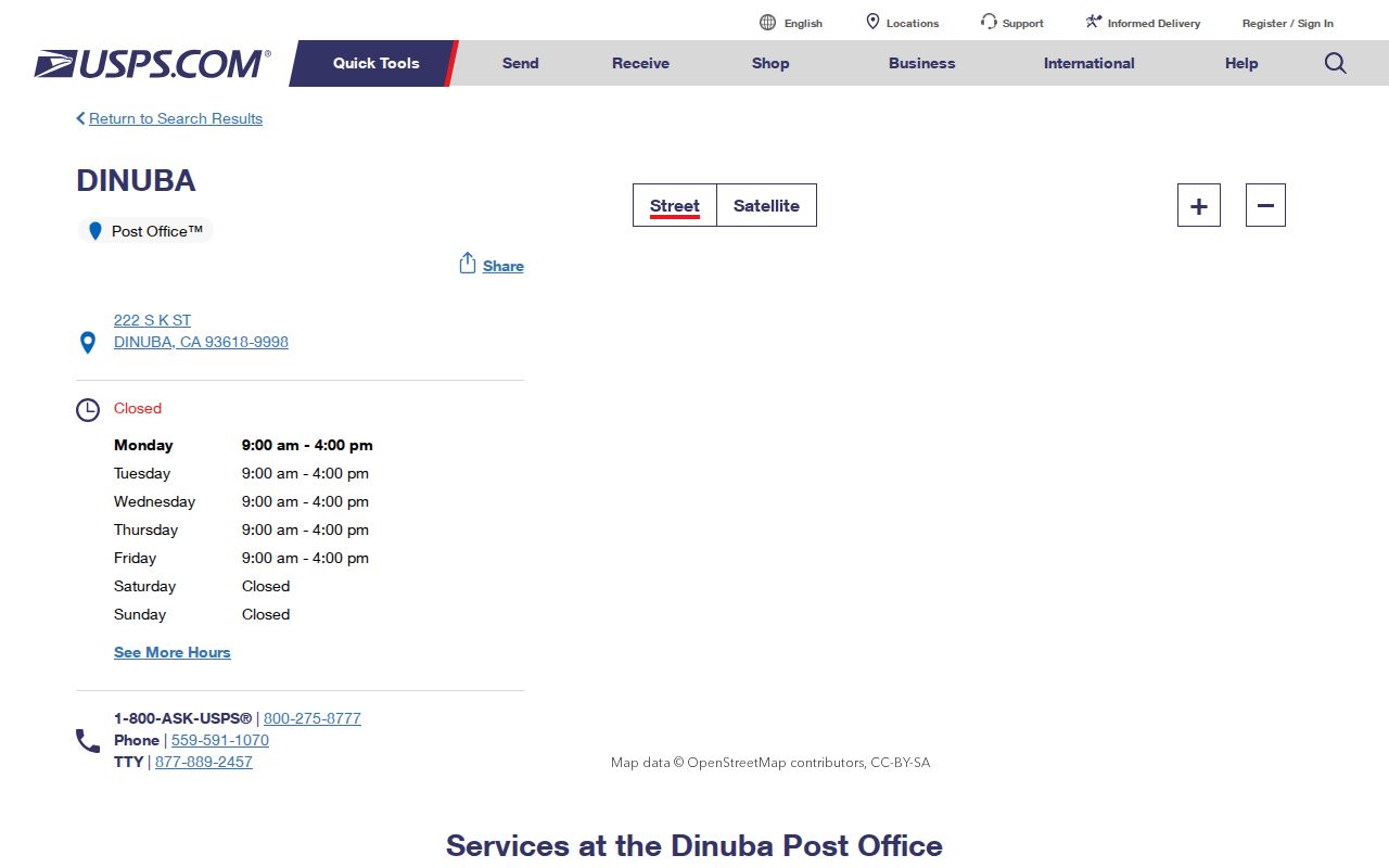
The retail counter at the Dinuba Post Office is listed for Monday through Friday, 9 a.m. to 4 p.m., with carrier, general-delivery, and PO Box services. The facility page is an access point for postal service, not a source for owner names or a city resident register.
The official Dinuba Post Office source page is the source for the capture below.
Carry the exact address forward, not just the five digits. USPS answers the delivery question. GIS can then test the parcel location, MPTS can retrieve assessment details, and city or county offices can be chosen from the parcel jurisdiction. That sequence keeps a postal result from being mistaken for a resident, ownership, or city record.
Residents in a Dinuba ZIP Code
No inspected Tulare local system accepts a ZIP-wide resident query. The useful workflow is address by address, with the ZIP acting as a check on delivery geography. Start with the postal result, then move to the parcel, recorder, voter, or municipal source that actually holds the needed record. Each step answers a different question and prevents a mailing label from doing work it cannot do.
- Verify the address. Run the complete address through USPS and record the returned delivery city and ZIP. Treat 93618 as postal evidence, not a city-limit finding.
- Locate the parcel. Search the Tulare County Public Parcel Search by APN or one-line address. Confirm the parcel, nearby polygons, and the jurisdiction shown by the map.
- Read assessment data. Use Tulare MPTS Property Search by Street Address, Fee Parcel, or Assessment. The result supplies the APN and current recorder document bridge, not an owner-name list.
- Follow the document trail. Use the current document number in the Tulare recorder index when an ownership instrument is the lawful research goal. Search by name or type only within the dates the index supports.
- Choose restricted sources with care. Use My Voter Status for one's own registration. A full Tulare voter-file request requires a specific purpose, signature, identification, and security terms, not a casual ZIP request.
After a ZIP has narrowed the address set, the Dinuba street directory handles the street-level parcel walkthrough. The ZIP step ends when the full address and jurisdiction are known; it does not create a list of every person who receives mail in 93618.
Dinuba ZIP Code Portal Fields
The local tools are useful precisely because their limits are visible. MPTS is an assessment and parcel search. GIS is a cadastral map. The recorder is an instrument index. Voter access is purpose restricted. None is a verified ZIP-capable local portal, so the search fields below should be read as a capability map rather than as one combined resident roll.
| Portal | Search fields or route | What it can show | ZIP limitation |
|---|---|---|---|
| Tulare MPTS Property Search | SEARCH BY: Fee Parcel, Assessment, Street Address; Search Term: 2 to 20 characters | APN, situs, current recorder document/date, values, exemptions, and property characteristics | No ZIP field, owner-name mode, or ZIP-wide query; omit street suffixes and use N/E/S/W as directed |
| Tulare County GIS | APN such as 123-456-789, or a one-line address/place | Parcel polygons, APN variants, map index, creation/termination documents and adjacent parcels | No ZIP-wide layer or radius owner report; the search returns at most six suggestions/results |
| Tulare Recorder Tyler index | Name, document number, document type, map book/page, and advanced legal criteria | Indexed parties, roles, dates, document number/type, book/page, and related instrument details | No ZIP or address-wide search; name/type begins in 1960, while known document numbers reach 1949 |
| My Voter Status and voter-file route | Individual self-lookup; separate application asks purpose, requester, organization, data requested, ID, signature, and security plan | One's own status, or approved voter fields such as residence, precinct, and participation history | Restricted by Elections Code §2194 and Government Code §7924.000; not a public ZIP or street directory |
The MPTS “Current Document Number” is the key bridge between an address and a recorder search. GIS can reveal which parcel touches another parcel and can expose creation or termination metadata. The recorder can identify parties to an instrument, but a deed still proves a recorded transaction, not everyone at the situs. Voter files add a separate legal gate. These distinctions are why no per-ZIP resident count is stated here.
The Tulare County Recorder's Office is in Room 103 at 221 S. Mooney Blvd. in Visalia, with lobby computers and counter access when the web index is not enough. The office lists phone service at (559) 636-5050, recording from 8 a.m. to 3 p.m., and certified copies through counter or mail routes. Earlier material may require terminals or microfiche. Staff can retrieve a known record, but they do not perform or advise on title searches.
Note: An APN or street field can locate a parcel, but it does not turn the portal into a ZIP code directory.
Dinuba Postal Counts Need Context
Household numbers show why a postal code cannot be treated as a ready-made resident roll. Census estimates for Dinuba report 6,735 households from 2020 to 2024, with an average of 3.76 people per household. A titled parcel can therefore stand for several household members, while a parcel record may not expose the owner name at all. The same household can also include people who do not appear in an ownership roll, and a rural 93618 address can sit outside the city line.
That is why no ZIP population, voter total, or resident count is supplied. USPS verifies delivery, GIS groups parcels, MPTS describes assessment data, the recorder indexes instruments, and the voter route follows a restricted purpose. Those layers answer different questions. Combining them into one number would suggest a completeness the local sources cannot support.
Note: Dinuba's household average explains the gap between parcel coverage and the number of people who may receive mail at an address.
Dinuba Postal Geography vs City Limits
93618 is a delivery area, not a legal outline of Dinuba. London Branch Library's Dinuba mailing address shows the mismatch in a concrete way: a rural place can use the Dinuba postal city while sitting outside incorporated city territory. Nearby 93666, 93654, and 93647 likewise should not be pulled into the Dinuba ZIP row simply because they are close. No verified ZIP split, realignment, or local ZIP boundary year was found.
For a city-side answer, Dinuba Planning and Development is at 1088 E. Kamm Ave., (559) 591-5921, with permit questions at (559) 591-5924, Monday through Friday, 8 a.m. to 5 p.m. Permit submissions may be emailed, though hard copies can be required. The current ePermits route is account-oriented and says residents can use it only for reroof permits, so it is not a public ZIP or address-history database. For older permit or code files, send a focused request through the Dinuba Public Records Act form with the situs, APN if known, record class, and date range. The city policy provides a ten-day disclosure determination and lists $0.10 per paper page.
Each label below answers a different question:
- ZIP versus ZIP+4
- A five-digit ZIP groups a postal delivery area. ZIP+4 adds four digits for a more precise delivery segment. Neither one sets a city line.
- PO-box ZIP
- A postal code used for box delivery at a post office. 93618 includes PO boxes, but no Dinuba PO-box-only ZIP was verified.
- Unique ZIP
- A code assigned to one organization or institution rather than a broad delivery area. No Dinuba unique ZIP was verified.
- Carrier route
- An internal delivery path used to organize addresses on a mail route. It is not a ward, parcel group, or resident list.
For local records, use the source that matches the address type. USPS standardizes delivery. GIS and MPTS key to the situs and APN. The recorder follows legal descriptions and indexed parties. City planning follows project location and municipal authority. A mismatch between those labels can be valid, so it should be documented rather than “fixed” by adding an unverified ZIP.
Nearby ZIP Codes, Not Dinuba ZIPs
93666, 93654, and 93647 are nearby postal codes associated with Sultana, Reedley, and Orosi. The research does not verify any of them as Dinuba ZIPs. Distance is not enough to add a code to a local directory. When an address returns one of those postal places, preserve the USPS result and let the parcel map identify the local jurisdiction. Do not relabel the result as 93618 because the address is near Dinuba.
The county record path can still remain relevant. Tulare County keeps the recorder, assessor, and GIS systems for land records across the county, while city planning and code access depend on where the parcel sits. That means a nearby postal code may still lead to the same county offices, but it does not make the address a Dinuba city record. The distinction also matters when a city request is sent to the wrong custodian. Confirm the parcel first, then ask the city or county office that controls the project, permit, or code file.
Dinuba's ZIP Grid and Railroad Core
Dinuba's address pattern adds another reason to use the full street line. The historic core runs northwest and southeast beside the former Southern Pacific alignment. Outside the rough Alta, El Monte, College, and Vassar frame, streets turn more clearly north-south and east-west. El Monte Way is the main east-west connector, Alta Avenue runs north-south, and Tulare Street with the H through M streets defines the downtown pattern. Newer areas include longer blocks, loops, and cul-de-sacs.
Those shifts do not establish a ZIP split. No authoritative citywide renumbering, renaming, E911 project, or ZIP realignment year was verified. The Dinuba General Plan background report provides broader street-form and development context. For MPTS, omit Street, Road, Drive, or Lane and use the directional form the search expects. For GIS, try the one-line address or APN format. For a deed, carry the APN and legal description forward. For a permit, identify the project site and date range. For USPS, keep the standardized delivery line.
Note: Dinuba's railroad-to-cardinal street change is an address clue, not evidence of a second ZIP or a city boundary.